Kittilä, Finland
Kittilä stands at a latitude of 67.8° north and is located approximately 170 km north of the Arctic Circle. It has its own airport and the nearest railway station is Kolari.
Getting to Kitillä by Air
You can fly direct to Kittilä at certain times of the year with British Airways, Finnair and Lufthansa,
At other times you can get a connecting flight via Helsinki.
Transfer from Kitillä by Bus
There are regular bus connections from the airport to surrounding areas which coincide with flight timings. Please refer to the destination resort for more information.
Bus Connections to Kittilä / Kolari
- www.vr.fi
- www.finnair.fi
- www.norwegian.com
- www.blue1.fi
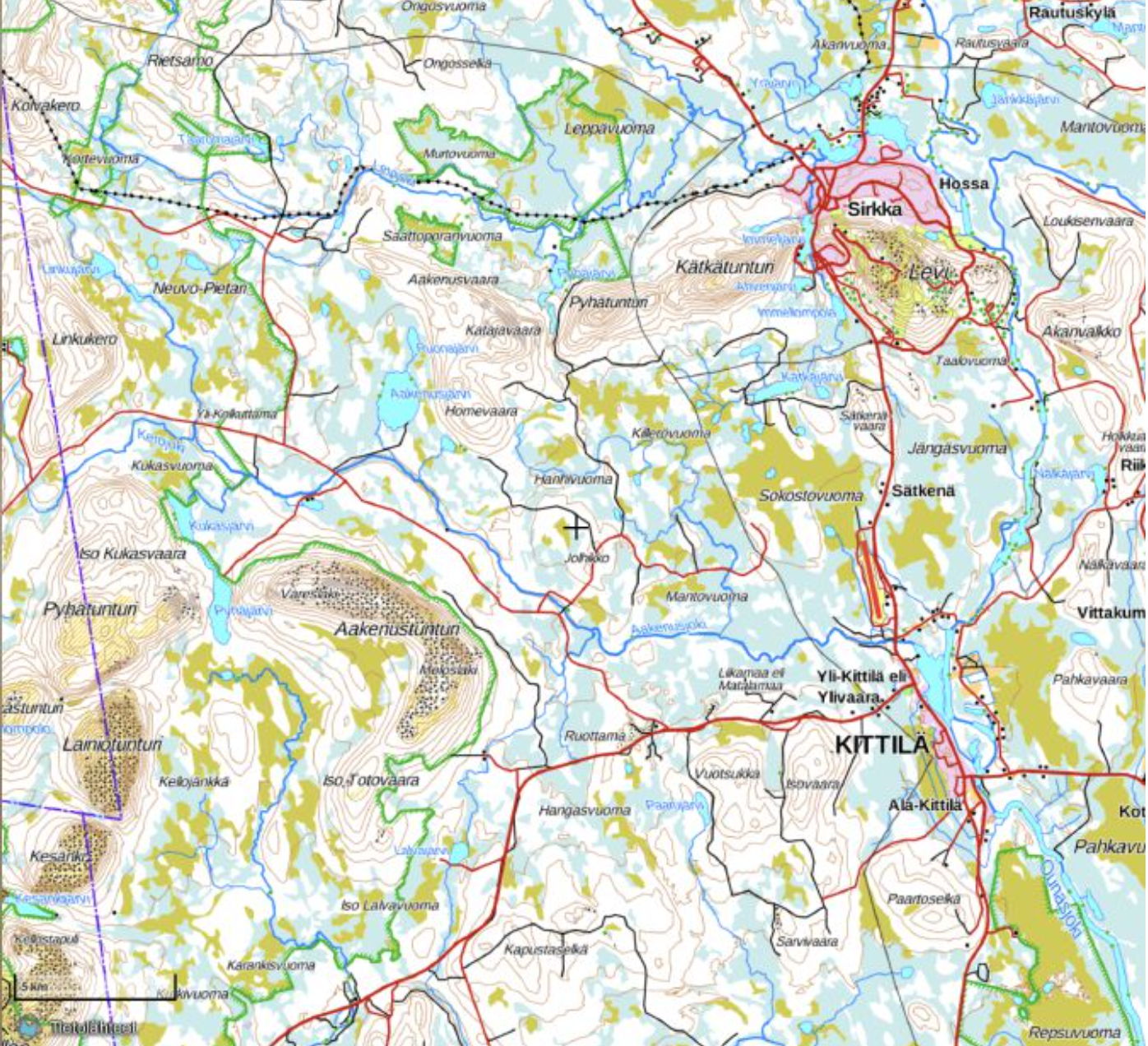
Map of Kitillä area
There are 10 fells in the area on the map:
- Aakenustunturi
- Korsatunturi
- Kumputunturi
- Kätkätunturi
- Kätkätunturi (northern)
- Lainiotunturi
- Levitunturi (Levi)
- Puljutunturi
- Pyhätunturi
- Pyhätunturi (western)
The map links to the National Land Survey of Finland website where you will need to zoom in for more detailed contouring. Or alternatively you can view a different version in Google maps .
When tracks are open to nearby Lapinkylä they connect with the Levi tracks. You can you ski from Kittilä and there is a café in Kultamaa, in the village of Kenttälä by the Nälkäjärvi lake which is 3 km before Lapinkylä. If you ski to Paartoselkä, you will reach a teepee along the Ylävitonen-track. The Särestöniemi track usually opens in March before the Särestöniemi skiing event.
Trails are maintained daily, but during heavy snow the tracks are cleared after snowfall has ended and in the following order:
1. Lit tracks (including Paartoselkä and Ylävitonen)
2. Honkavaara route
3. Isovaara
4. Route that leads to Levi
Lit Tracks
The main skiing trail in Kittilä is lit up daily between 6am to 10pm. The main trails in Levi are lit up daily between 6am to 11pm. As the spring progresses and the days are filled with more natural light, the trail lights turn off accordingly.
Kitillä Cross Country Ski Routes
Cafes on Cross Country Ski Routes
On the Lapinkylä track that connects with Levi tracks when you ski it from Kittilä, there is a café in Kultamaa, in the village of Kenttälä by the Nälkäjärvi lake which is 3 km before Lapinkylä.
If you ski to Paartoselkä, you will reach a teepee along the Ylävitonen-track.


